By: Yang Ju 
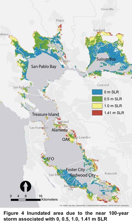 In the San Francisco Bay Area (the Bay Area), one of the greatest concerns of global climate change is inundation from sea level rise (SLR) associated with extreme storms. The projected 1.41 m SLR will inundate many of Bay Area’s low-lying coastal areas, including populated development and ecologically important tidal marshes. Therefore, it’s critical to spatially map the inundation and then develop subsequent adaptation strategies to mitigate the impact. Differing from previous static models, we use the 3Di hydrodynamic model simulate a near 100-year storm associated with different levels of SLR at a 50-meter spatial resolution, in order to capture the dynamics of semi-diurnal tides in the Bay. The model produces a time-series with a 1-hour interval simulated inundation with both extent and depth outputs. Based on the outputs, we find there is a significant increase in inundated areas with rising sea level, especially for developed regions and wetlands. Immediate planning and design actions are required to avoid
Mapping Sea Level Rise & Storm Inundation by 3DI Hydrodynamic Model
Reply
